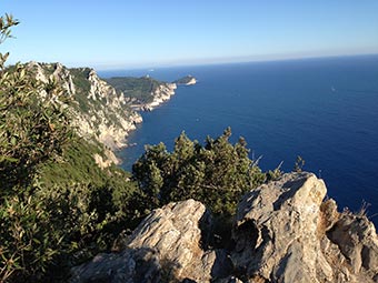
The High Path - AV5T (ex. #1)
 Open Google Map in a new window
The High Path is the second most visited place after the Blue Path (the first and last parts only). It is rather interesting crossing through the entire Cinque Terre Park and connecting Portovenere and Levanto.
It can be divided into five sections, but are officially called identically as "Path number 1 (AV5T)". Total length: about 35 km / 22 miles.
With the help of the map above, you can know the path route in advance. For more detailed information, download  this file and run it in Google Earth to see the route in 3D; moreover you can also estimate the altitudes of all these paths.
|
 1/a. Portovenere - Pass of Telegrafo. 1/a. Portovenere - Pass of Telegrafo.
The most popular section among tourists going to Portovenere from Riomaggiore. More details on how to reach the trail from the village can be found on the village page.
Difficulty: low*.
Height (meters): beginning: 2; end: 513; maximal: 568.
Height (feet): beginning: 7; end: 1684; maximal: 1864.
Length: 8.7 km / 5.5 miles.
Journey time: 3-4 hours.
Status: open.
|
|
1a. Muzzerone Fort.
Not far from Portovenere, the track is divided into 2 paths: 1 and 1a. The second part is longer than the first one by almost 1 km, but it goes through Muzzerone Fort currently used by the Italian Army as a training base.
Difficulty: low*.
Height (meters): beginning: 170; end: 250; maximal: 310.
Height (feet): beginning: 558; end: 821; maximal: 1018.
Length: 1.5 km / 1 mile.
Journey time: 30-50 minutes.
Status: open. |
|
1/b. Pass of Telegrafo - Cigoletta.
Starting from this section, the path goes along the top of the mountains. Its altitude reaches 700 meters. In contrast to other paths, the panoramic view is available now on the opposite side of the ridge as well.
Difficulty: low*.
Height (meters): beginning: 513; end: 611; maximal: 750.
Height (feet): beginning: 1684; end: 2005; maximal: 2461.
Length: 6 km / 3.7 miles.
Journey time: 2-3 hours.
Status: open. |
|
1/c. Cigoletta - Termine.
Like the preceding section, this path goes along the top of the mountains. It is the highest part of in the entire Cinque Terre, as it passes through the top of Malpertuso peak with a maximum altitude of 812 meters.
Difficulty: low*.
Height (meters): beginning: 611; end: 543; maximal: 812.
Height (feet): beginning: 2005; end: 1782; maximal: 2665.
Length: 8.5 km / 5.3 miles.
Journey time: 3-3.30 hours.
Status: open. |
|
1/d. Termine - Cape of Mesco.
The main part of this section is the border of the Cinque Terre region. Monterosso is situated on one side, and Levanto - on the other. The path crosses Cape of Mesco, the highest in the Cinque Terre, which is why you can see all the five Cinque Terre villages from here. The panoramic view, indeed, is stunning.
Difficulty: low*.
Height (meters): beginning: 543; end: 326; maximal: 465.
Height (feet): beginning: 1782; end: 1070; maximal: 1526.
Length: 7 km / 4.3 miles.
Journey time: 3-3.30 hours.
Status: open. |
|
 1/e. Cape of Mesco - Levanto. 1/e. Cape of Mesco - Levanto.
The second by popularity section of the path number 1, as tourists going from Monterosso to Levanto use this path. Most of the visitors admire the panoramic view from the Cape of Mesco through which this track passes.
Difficulty: low*.
Height (meters): beginning: 326; end: 0; maximal: 326.
Height (feet): beginning: 1070; end: 0; maximal: 1070.
Length: 4.5 km / 2.8 miles.
Journey time: 2-2.30 hours.
Status: open.
|
*Note about difficulties:
None - trail does not have any difficulties, its height almost does not vary, and there are no complex sections.
Low - trail goes along paths with very well indicating signs. No preparation is needed, besides a bit of orientation with the terrain and stamina for long walks.
Average - some sections of the path do not have signs everywhere, so you will need some level of orientation with the terrain and minimal physical training is needed for crossing some sections.
Photos of the High Path #1:
 Open Google Map in a new window
![]() this file and run it in Google Earth to see the route in 3D; moreover you can also estimate the altitudes of all these paths.
this file and run it in Google Earth to see the route in 3D; moreover you can also estimate the altitudes of all these paths.


