Other walking paths in Cinque Terre
 Open Google Map in a new window
This page provides information about lot of other paths. If you do not have enough time for visiting the Cinque Terre, just check the main paths: SVA (ex. #2) the Blue Path and the High Path AV5T (ex. #1) that are described in details on the corresponding pages.
Indeed, the number of the paths is much more, but these are the main ones that can be of interest for tourists.
With the help of the map above, you can know the path route in advance. For more detailed information, download  this file and run it in Google Earth to see the route in 3D; moreover you can also estimate the altitudes of all these paths.
|
 531. Riomaggiore - Manarola (Beccara). 531. Riomaggiore - Manarola (Beccara).
The road is not long, but in the beginning it climbs sharply, you have to overcome more than 600 steps.
Difficulty: average*.
Height (meters): beginning: 30; end: 64; maximal: 250.
Height (feet): beginning: 99; end: 210; maximal: 821.
Length: 1.35 km.
Journey time: 1 hour.
Status: open.
|
|
  SVA-593 (ex. 3). Riomaggiore - Pass of Telegrafo - Biassa. SVA-593 (ex. 3). Riomaggiore - Pass of Telegrafo - Biassa.
This path is called "Via Lemmen" ("The Lemmen Way"). It connects Riomaggiore with the Montenero sanctuary, the path #1 (Telegrafo) and the hamlet of Biassa. You can take one of the two paths to reach Portovenere from Riomaggiore.
Difficulty: low*.
Height (meters): beginning: 8; end: 513; maximal: 513.
Height (feet): beginning: 27; end: 1684; maximal: 1684.
Length: 4 km / 2.5 miles.
Journey time: 1.30-2 hours.
Status: open.
|
|
  593V (ex. 3a). Riomaggiore - Pass of Telegrafo. 593V (ex. 3a). Riomaggiore - Pass of Telegrafo.
"The Cherico Path": connects the same places as the path #3, but there is a steep slope making the trek more hiring. But it takes less time, being shorter, for example, it will take you about 20-30 minutes only to reach the sanctuary of Montenero. The temple is situated only one kilometre (0.6 miles) away from Riomaggiore.
Difficulty: low*.
Height (meters): beginning: 8; end: 513; maximal: 513.
Height (feet): beginning: 27; end: 1684; maximal: 1684.
Length: 3.2 km / 2 miles.
Journey time: 1.20-1.40 hours.
Status: open.
|
|
 504 (ex. 4). Biassa - Schiara (sea). 504 (ex. 4). Biassa - Schiara (sea).
Difficulty: low* (average* at descent to the sea).
Height (meters): beginning: 511; end: 0; maximal: 511.
Height (feet): beginning: 1677; end: 0; maximal: 1677.
Length: 3.5 km / 2.2 miles.
Journey time: 1-1.30 hours.
Status: open.
|
|
AVG (ex. 4a). Biassa - Campiglia.
Difficulty: low*.
Height (meters): beginning: 513; end: 400; maximal: 513.
Height (feet): beginning: 1684; end: 1313; maximal: 1684.
Length: 3.3 km / 2 miles.
Journey time: 1-1.30 hours.
Status: open. |
|
535 (ex. 4b). Trail 4c - Campiglia.
It also passes through the hamlets of: Fossola, Campi.
Difficulty: low*.
Height (meters): beginning: 258; end: 400; maximal: 400.
Height (feet): beginning: 847; end: 1313; maximal: 1313.
Length: 3 km / 1.9 miles.
Journey time: 1-1.30 hours.
Status: open. |
|
534 (ex. 4c). Trail 1 - Cape of Merlino.
Majority of the tourists, searching for more complicated sections, turns from the High Path #1 to this one for takeing rest at the Cape of Merlino or even descending to the sea.
Difficulty: average* (more complicated if descending to the sea).
Height (meters): beginning: 511; end: 0; maximal: 511.
Height (feet): beginning: 1677; end: 0; maximal: 1677.
Length: 1.2 km / 0.7 miles.
Journey time: 1.20-2 hours.
 The descent to the coast is temporarily inaccessible. The descent to the coast is temporarily inaccessible. |
|
 536 (ex. 4d). Trail 4 - Cape of Monesteroli. 536 (ex. 4d). Trail 4 - Cape of Monesteroli.
Just like the path 4c, tourists turn to this one as well (first you will need to pass a part of the path #4). The Cape of Monesteroli attracts many people, and there are many interesting paths between these two capes.
Difficulty: low* (average* at descent to the sea).
Height (meters): beginning: 511; end: 0; maximal: 511.
Height (feet): beginning: 1677; end: 0; maximal: 1677.
Length: 1 km / 0.6 miles.
Journey time: 20-30 minutes to descend and one hour for the way back.
Status: open.
|
|
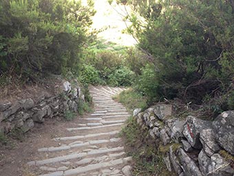 506 (ex. 6). Manarola - Trail 1. 506 (ex. 6). Manarola - Trail 1.
It connects Manarola and Volastra (this hamlet’s inhabitants founded Manarola a long time ago), the "Salute" Sanctuary and the path #1. In order to reach Volastra (and the sanctuary), you will need about 30 minutes, it is less than 1 km / 0.6 miles, but keep in mind that the track is steep and is composed of approximately 1200 steps.
Difficulty: low* (average on the road to Volastra).
Height (meters): beginning: 20; end: 667; maximal: 667.
Height (feet): beginning: 66; end: 2189; maximal: 2189.
Length: 3.2 km / 2 miles.
Journey time: 1.40-2.20 hours.
Status: open.
|
|
506V (ex. 6'). Detour.
Like the path #6, it connects Manarola with the High Path, but it goes through the hamlet of Groppo and the sanctuary. Only the section that is different from path 6 has been indicated, further the paths merge again.
Difficulty: low*.
Height (meters): beginning: 100; end: 200; maximal: 200.
Height (feet): beginning: 329; end: 657; maximal: 657.
Length: 1.2 km / 0.7 miles.
Journey time: 30-45 minutes.
Status: open. |
|
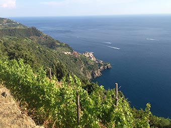  586 (ex. 6d). Volastra - Trail 7a. 586 (ex. 6d). Volastra - Trail 7a.
This path is called "Porcina", it connects Volastra and Case Pianca, which is not far from Corniglia.
Difficulty: low*.
Height (meters): beginning: 335; end: 350; maximal: 400.
Height (feet): beginning: 1100; end: 1149; maximal: 1313.
Length: 2.2 km / 1.4 miles.
Journey time: 50-75 minutes.
Status: open.
|
|
  6p. Manarola - Panoramic view - Trail 6. 6p. Manarola - Panoramic view - Trail 6.
It's better to start your trek to Volastra with this path, where you can enjoy beautiful panoramic view of Manarola, Corniglia and the coast. Next, the trail merges with path number 6, which goes up to Volastra.
Difficulty: low*.
Height (meters): beginning: 20; end: 100; maximal: 100.
Height (feet): beginning: 66; end: 329; maximal: 329.
Length: 1 km / 0.6 miles.
Journey time: 20 minutes.
Status: open.
|
|
  507 (ex. 7). Vernazza - San Bernardino - Trail 1. 507 (ex. 7). Vernazza - San Bernardino - Trail 1.
It connects Vernazza with La Cigoletta mountain through which passes path #1; it also crosses one very beautiful hamlet: San Bernardino home to a shrine Corniglia - Our Lady of Graces. It is located approximately in the middle of the path.
Difficulty: low*.
Height (meters): beginning: 10; end: 612; maximal: 667.
Height (feet): beginning: 33; end: 2008; maximal: 2189.
Length: 3.3 km / 2 miles.
Journey time: 1.10-1.30 hours
Status: open.
|
|
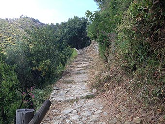 587 (ex. 7a). Corniglia - Trail 1. 587 (ex. 7a). Corniglia - Trail 1.
Difficulty: low*.
Height (meters): beginning: 100; end: 612; maximal: 612.
Height (feet): beginning: 329; end: 2008; maximal: 2008.
Length: 2.2 km / 1.4 miles.
Journey time: 1-1.30 hours.
Status: open.
|
|
508 (ex. 8). Vernazza - Trail 1.
It connects Vernazza with the "Reggio" Sanctuary and path #1. To reach the sanctuary, you need to walk half of this path spending about 40 minutes.
Difficulty: low*.
Height (meters): beginning: 10; end: 500; maximal: 500.
Height (feet): beginning: 33; end: 1641; maximal: 1641.
Length: 2.9 km / 1.8 miles.
Journey time: 1-1.30 hours.
Status: open. |
|
581 (ex. 8a). San Bernardino - Trail 8.
Difficulty: low*.
Height (meters): beginning: 307; end: 208; maximal: 330.
Height (feet): beginning: 1008; end: 683; maximal: 1083.
Length: 3.7 km / 2.3 miles.
Journey time: 1.40-2 hours.
Status: open. |
|
 582 (ex. 8b). Trail 1 - Trail 8. 582 (ex. 8b). Trail 1 - Trail 8.
It connects the "Reggio" Sanctuary of Vernazza with the "Soviore" Sanctuary of Monterosso through which the High Path #1 passes.
Difficulty: low*.
Height (meters): beginning: 465; end: 208; maximal: 465.
Height (feet): beginning: 1526; end: 683; maximal: 1526.
Length: 2.6 km / 1.6 miles.
Journey time: 1-1.20 hours.
Status: open.
|
|
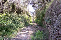 509 (ex. 9). Monterosso - Trail 1. 509 (ex. 9). Monterosso - Trail 1.
It connects Monterosso with its "Soviore" Sanctuary and path #1 as well. The sanctuary is situated at the very end of this path.
Difficulty: low*.
Height (meters): beginning: 5; end: 465; maximal: 465.
Height (feet): beginning: 17; end: 1526; maximal: 1526.
Length: 2 km / 1.2 miles.
Journey time: 50-70 minutes.
Status: open.
|
|
  SVA-590 (ex. 10). Monterosso - Cape of Mesco. SVA-590 (ex. 10). Monterosso - Cape of Mesco.
A very popular path among tourists. It is the shortest way to reach San Antonio Monastery situated on the very beautiful Cape of Mesco from where you get a panoramic view over the entire Cinque Terre that cannot be explained in words.
Difficulty: low*.
Height (meters): beginning: 5; end: 313; maximal: 315.
Height (feet): beginning: 17; end: 1027; maximal: 1034.
Length: 2.2 km / 1.4 miles.
Journey time: 1-1.20 hours (it is less backward).
Status: open.
|
|
528 (ex. 11). Campiglia - Beach of Persico.
Difficulty: low*.
Height (meters): beginning: 400; end: 0; maximal: 400.
Height (feet): beginning: 1313; end: 0; maximal: 1313.
Length: 1.2 km / 0.7 miles.
Journey time: 30-45 minutes for descent and 60-70 minutes backward.
Status: open. |
|
11a. Trail 1 - Sea.
Difficulty: average* (descent to the sea is complex).
Height (meters): beginning: 400; end: 0; maximal: 403.
Height (feet): beginning: 1313; end: 0; maximal: 1323.
Length: 1.2 km / 0.7 miles.
Journey time: 40-60 minutes.
 The main part of the trail is closed. The main part of the trail is closed. |
|
572 (ex. 14). Levanto - Trail 1.
This path, just like #22 (they are very similar and run literally parallel to each other), is used to pass the route "Ring of Levanto", which consists of trail #14 (or 22), then the trail #1/d to Cape of Mesco and finally returning to Levanto using trail 1/e, but many tourists prefer going to Monterosso with trail #10.
Difficulty: low*.
Height (meters): beginning: 0; end: 484; maximal: 484.
Height (feet): beginning: 0; end: 1588; maximal: 1588.
Length: 2.6 km / 1.6 miles.
Journey time: 1-1.30 hours.
Status: open. |
|
573 (ex. 22). Levanto - Trail 1.
This path, just like #14 (they are very similar and run literally parallel to each other), is used to pass the route "Ring of Levanto", which consists of trail #22 (or 14), then the trail #1/d to Cape of Mesco and finally returning to Levanto using trail 1/e, but many tourists prefer going to Monterosso with trail #10.
Difficulty: low*.
Height (meters): beginning: 0; end: 360; maximal: 360.
Height (feet): beginning: 0; end: 1182; maximal: 1182.
Length: 2.5 km / 1.5 miles.
Journey time: 1-1.30 hours.
Status: open. |
|
501 (ex. 01). Riomaggiore - La Croce.
Difficulty: low*.
Height (meters): beginning: 8; end: 637; maximal: 637.
Height (feet): beginning: 27; end: 2090; maximal: 2090.
Length: 2.4 km / 1.5 miles.
Journey time: 1.30-2 hours.
Status: open. |
|
502 (ex. 02). Volastra - Trail 1.
Difficulty: low*.
Height (meters): beginning: 300; end: 708; maximal: 708.
Height (feet): beginning: 985; end: 2323; maximal: 2323.
Length: 2.2 km / 1.4 miles.
Journey time: 1 hour.
Status: open. |
|
530 (ex. X1). Montenero - Volastra.
Many people call this path "The Saints Way". It connects the "Montenero" shrine of Riomaggiore with the "Salute" shrine of Manarola and is rather a decent detour. This path is usually negotiated on bikes. After Volastra you can continue travelling by bike up to Levanto. It is a rather interesting route!
Difficulty: low*.
Height (meters): beginning: 300; end: 180; maximal: 360.
Height (feet): beginning: 985; end: 591; maximal: 1182.
Length: 8 km / 5 miles.
Journey time: 3 hours, if on foot.
Status: open. |
*Note about difficulties:
None - trail does not have any difficulties, its height almost does not vary, and there are no complex sections.
Low - trail goes along paths with very well indicating signs. No preparation is needed, besides a bit of orientation with the terrain and stamina for long walks.
Average - some sections of the path do not have signs everywhere, so you will need some level of orientation with the terrain and minimal physical training is needed for crossing some sections.
 Open Google Map in a new window
![]() this file and run it in Google Earth to see the route in 3D; moreover you can also estimate the altitudes of all these paths.
this file and run it in Google Earth to see the route in 3D; moreover you can also estimate the altitudes of all these paths.


 The descent to the coast is temporarily inaccessible.


 The main part of the trail is closed.


